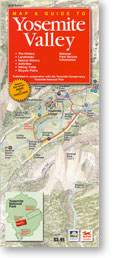
“Covering Yosemite National Park and attractions of nearby Inyo National Forest, this may be the only guide you need for Yosemite’s high country.”

Map & Guide to
Tuolumne Meadows $3.95
5th Edition 2015
10″ x 38″
Folds to 4″ x 10 “
Click on the image below to view a detail:


Includes:
History
Landmarks
Natural History
Activities
Hiking Trails
Camping
Published in cooperation with the YosemiteConservancy
“Two distinct map views guide you through Yosemite’s high country with information on the trails, geology, history, wildlife and activities available during a summer visit to Tuolumne Meadows. With lodging, camping and dining information, you’ll also find services and attrac- tions adjacent to the eastern entrance of Yosemite National Park.”
Michelle Hansen, Yosemite Conservancy
“This map is a real work of art that shows the day hikes in and around Tuolumne Meadows. This is a beautiful, oft ignored area of Yosemite National Park. This map serves well both as a trip planning tool and as a souvenir. Really hard to beat at this price!“
Yosemite Online Store
This Tuolumne Meadows paper map covers Yosemite’s high country and nearby Inyo National Forest – likely the only guide you need for a summer visit, with two distinct 3D bird’s-eye map views, trail info, geology, wildlife, and camping and lodging near the park’s eastern entrance. Published in cooperation with the Yosemite Conservancy.
Tioga Road, the only road into this part of the park, closes for roughly half the year – usually late fall through late spring, depending on snowpack – so this is genuinely a summer-and-early-fall destination. Cell service up here (8600 ft elevation) is even less reliable than the valley floor, and the granite domes and alpine meadows that make this area worth visiting are exactly the kind of terrain where a paper map that doesn’t need a signal or a charge is the difference between a planned hike and a guess.